Geography Of India | Indian Geography » Longitude & Latitudinal
Geography Of India | Indian Geography Is A Country In The Continent Of Asia , Which Is Surrounded By Seas On Three Sides At The Top Of The Indian Ocean In The Southern Part Of Asia.
The Whole Of India Falls In The Northern Hemisphere.
The Latitudinal Extension Of India Is From 8°4′ North Latitude To 37°6 North Latitude.
The Longitude Extension Of India Is From 68°7′ East Longitude To 97°25′ East Longitude. ,
The Area Of India Is 32,87,263 Sq Km. Is.
India Ranks Seventh In The World In Terms Of Area. It Is About 1/5 Of The Area Of Russia, No. It Is 1/3 Of The Area Of America And Of The Area Of Australia.
In Terms Of Population, India Is Second Only To China In The World.
India Has 2.4% Of The World’s Land While About 17.5% Of The World’s Population Lives In India.
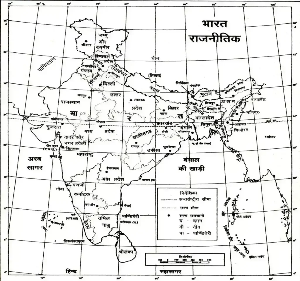
India Is Bounded By Nepal, Bhutan And China In The North, Sri Lanka And The Indian Ocean In The South, Bangladesh, Myanmar And The Bay Of Bengal In The East And Pakistan And The Arabian Sea In The West. The Sea Area Separating India From Sri Lanka Is The Gulf Of Mannar And The Palk Strait.
The Southernmost Point Of Peninsular India Is Kanyakumari.
Far Southernmost Point Of India – Indira Point (Gate Is In Nicobar).
India’s Northern End Point Is Indira Call.
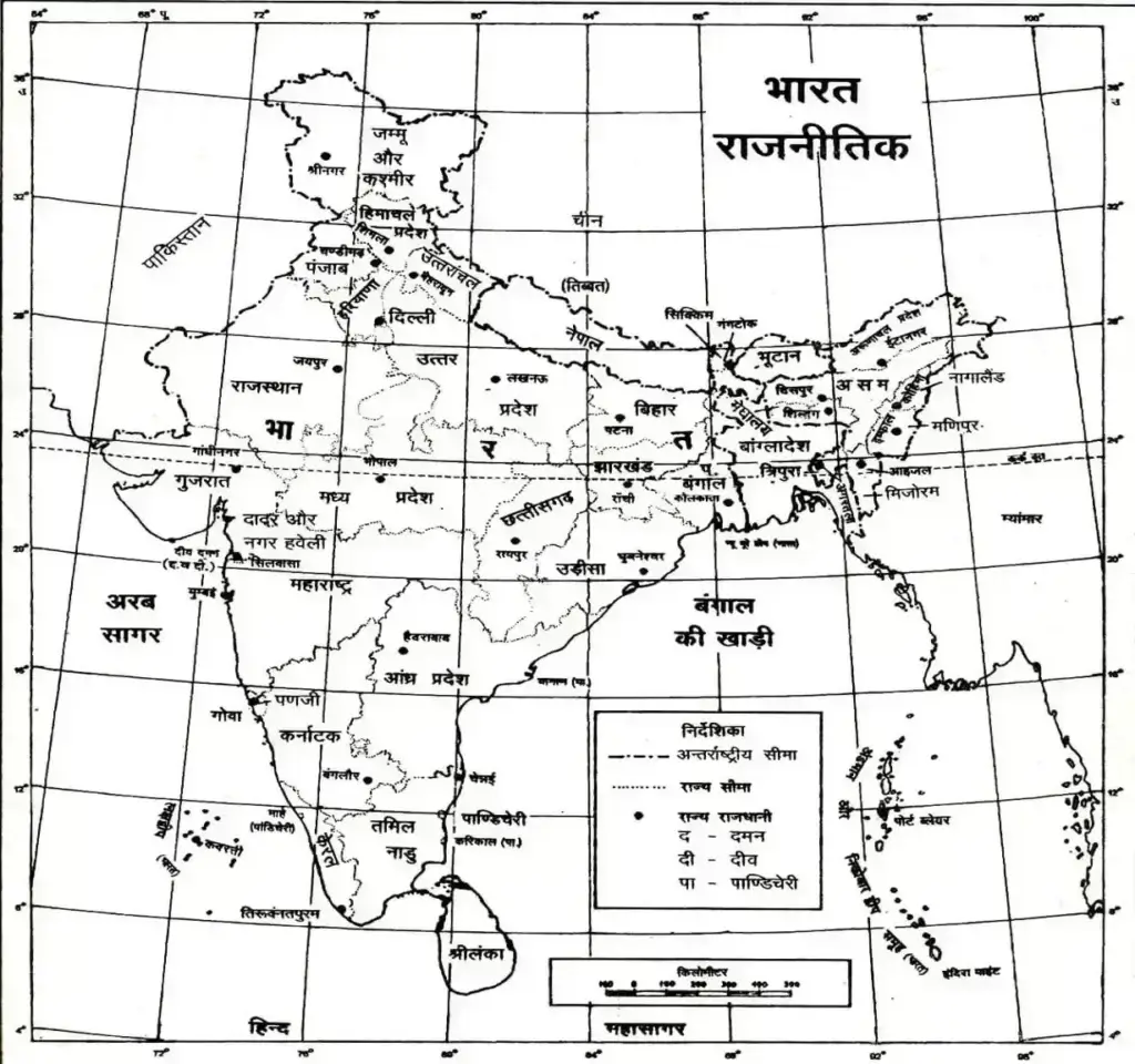
Geography Of India | Indian Geography – Boundary Point
- Southernmost Point – Indira Point (Great Nicobar Island)
- Northern Point- Indira Kol (Jammu-Kashmir)
- West Point- Rajhar Keek (Gujarat)
- East Point- Walangu (Arunachal Pradesh).
- The Mainland Border- Kanyakumari (Tamil Nadu)
| Country | Bordering Indian States |
|---|---|
| Pakistan (4) | Gujarat, Rajasthan, Punjab, Jammu And Kashmir |
| Afghanistan (1) | Jammu And Kashmir |
| China (5) | Jammu And Kashmir, Himachal Pradesh, Uttaranchal, Sikkim, Arunachal Pradesh |
| Nepal (5) | Uttar Pradesh, Uttaranchal, Bihar, West Bengal, Sikkim |
| Bhutan (4) | Sikkim, West Bengal, Assam, Arunachal Pradesh |
| Bangladesh (5) | West Bengal, Assam, Meghalaya, Tripura, Mizoram |
| Myanmar (4) | Arunachal Pradesh, Nagaland, Manipur, Mizoram |
| India-Bangladesh Border | 4096 Km |
|---|---|
| Indo-China | 3439 Km |
| Indo Pak Border | 3310 Km |
| Indo-Nepal Border | 1761 Km |
| Indo-Myanmar Border | 1643 Km |
| Indo-Bhutan Border | 587 Km |
Geography Of India | Indian Geography – Salient Points
- The Tropic Of Cancer Passes Through The Middle Of India.
- Indian Standard Time Is Derived From Naini Near Allahabad, Whose Longitude Is 82°30′ East. (Currently Mirzapur) It Is 5 Hours 30 Minutes Ahead Of Greenwich Mean Time (GMT).
- The Length Of India From North To South Is 3214 Km. And 2933 Km From East To West. Is.
- The Maritime Boundary Of India Is 7516.6 Km. While The Length Of The Terrestrial Boundary Is 15,200 Km. Is. The Coastline Of Mainland India Is 6,100 Km. Is.
- Rajasthan Is The Largest State Of India In Terms Of Area.
- Uttar Pradesh Is The Largest State In The Country In Terms Of Population.
- Goa Is The Smallest State In India In Terms Of Area.
| State | Area Sq Km |
|---|---|
| Rajasthan | 3422239 |
| Madhya Pradesh | 308245 |
| Maharashtra | 307713 |
| Andhra Pradesh | 275069 |
| Uttar Pradesh | 240928 |
| District | Area Sq Km |
|---|---|
| Raw | 45652 |
| Leh | 45110 |
| Jaisalmer | 38428 |
| Barmer | 28387 |
| Bikaner | 27284 |
- Sikkim Is The Smallest State In India In Terms Of Population.
- Andaman And Nicobar Islands Is The Largest Union Territory In Terms Of Area.
- Lakshadweep Is The Smallest Union Territory In Terms Of Area.
- Delhi Is The Largest Union Territory In Terms Of Population.
- Lakshadweep Is The Smallest Union Territory In Terms Of Population.
- Madhya Pradesh Is The Largest Plateau State Of India.
- Rajasthan Is The Largest Desert State Of India.
- Forest (Forest) Is Highest In Madhya Pradesh.
- The Total Number Of Islands In India Is 248, There Are 223 Islands In The Bay Of Bengal And 25 Islands In The Arabian Sea.
- The Southernmost Tip Of India Is Named ‘Indira Point’ And It Is Located On The Great Nicobar Island In The Bay Of Bengal.
- Indira Call, The Northernmost Point Of India, Is Located In Jammu And Kashmir.
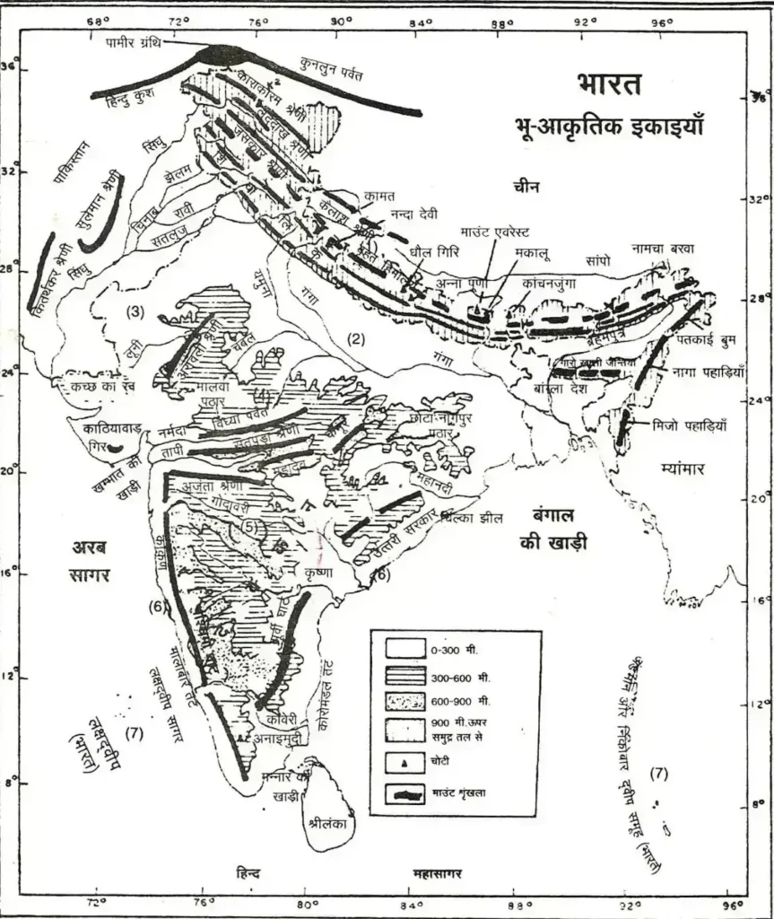
- The Eastern Ghats Are Known As The Coramandal Coast.
- The Western Ghats Are Known As The Malabar Coast.
- The States Of India Through Which The Tropic Of Cancer Passes Are- Gujarat, Rajasthan, Madhya Pradesh, Chhattisgarh, Jharkhand, West Bengal, Tripura And Mizoram. Indian Standard Time’s Longitude Line (82°30′) Uttar Pradesh, Central Uttisgarh Passes Through Odisha And Andhra Pradesh
- The Border Of Uttar Pradesh Touches Most Of The States (8) – Uttaranchal, Himachal Pradesh, Haryana, Rajasthan, Madhya Pradesh, Chhattisgarh, Jharkhand And Bihar.
- The State With The Largest Number Of Cities In India Is Uttar Pradesh While Meghalaya Has The Least Number Of Cities.
- Maharashtra Is The State With The Largest Urban Population In India, While Sikkim Has The Least Urban Population.
- The Population Of Working Persons In India Is 4.02 Crores.
- The Total Length Of Road In India Is 18,43,420 Km.
- India’s Longest National Highway Number 7 Is Which Runs From Banaras To Kanyakumari (2369 Km).
- The Total Length Of Railways In India Is 64,140 Km. The Cities Of Thiruvananthapuram And Cochin (Kerala) Receive The First Rainfall Of Monsoon.
| Geography Of India | Indian Geography – Divided Site Segment | Channel/Bay/Strait |
|---|---|
| Indira Point – Indonesia | Great Channel |
| Little Andaman And Nicobar | 10° Channel |
| Minicoy-Lakshadweep | 9° Channel |
| Maldives-Minicoy | 8° Channel |
| India-Sri Lanka | Bay Of Mannar |
| Gulf Of Pak | Pak Strait |

